| Name |
|
Description |
| SHIS_BT_1579-1613_0138Z_120912.png |
|
S-HIS BT (1579-1613) at 0138Z 12 Sep 2012 - In region of dry SAL air, based on CIMSS SAL tracking product.
|
| SHISandSAL_0145Z.png |

|
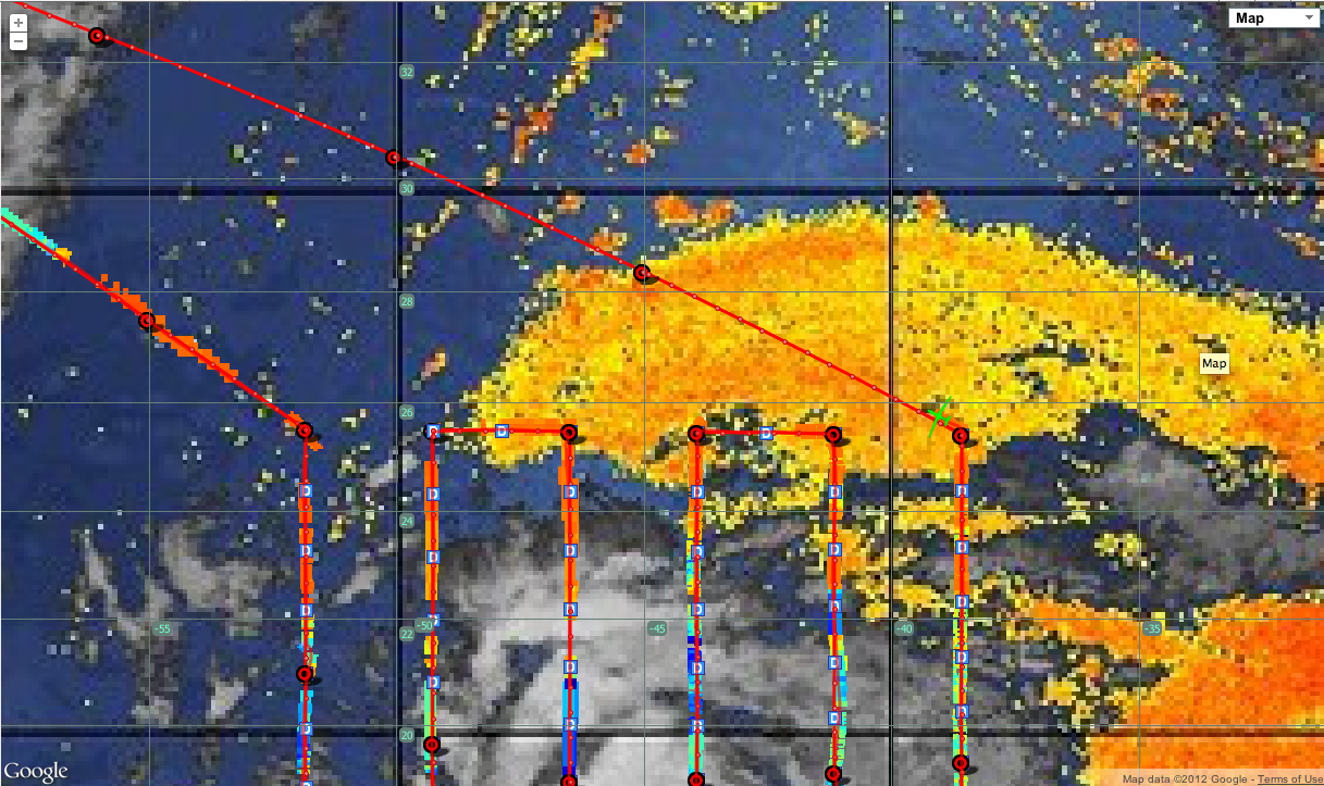
S-HIS BT (1579-1613) over CIMSS SAL Tracking Product at 0145Z 12 Sep 2012 - Sampling region of dry SAL air, based on CIMSS SAL tracking product.
|
| SHISandSAL_0145Z_wideView.png |

|
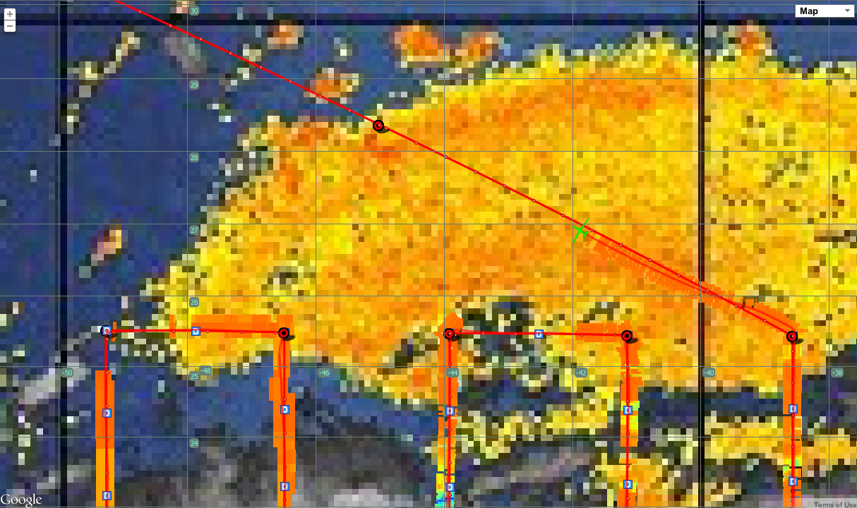
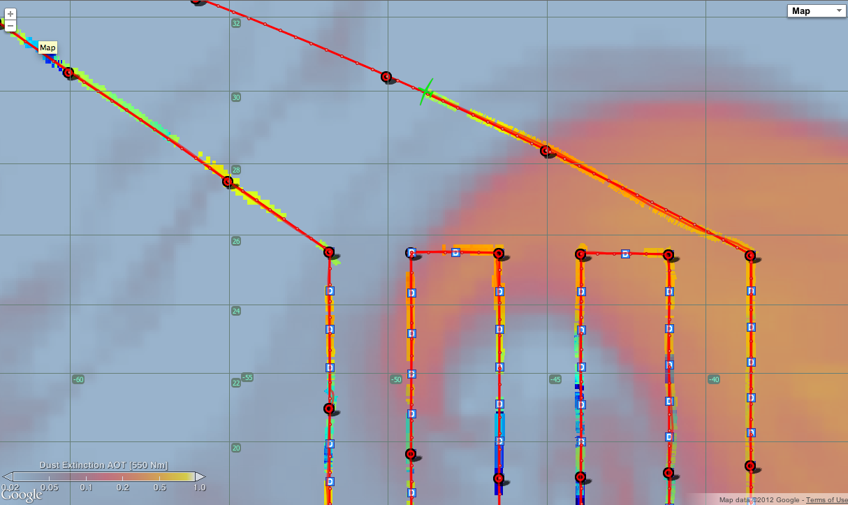
S-HIS BT (1579-1613) over CIMSS SAL Tracking Product at 0145Z 12 Sep 2012 (zoomed out) - Sampling region of dry SAL air, based on CIMSS SAL tracking product.
|
| SHISandSAL_0145Z_fullAtlBasin.png |
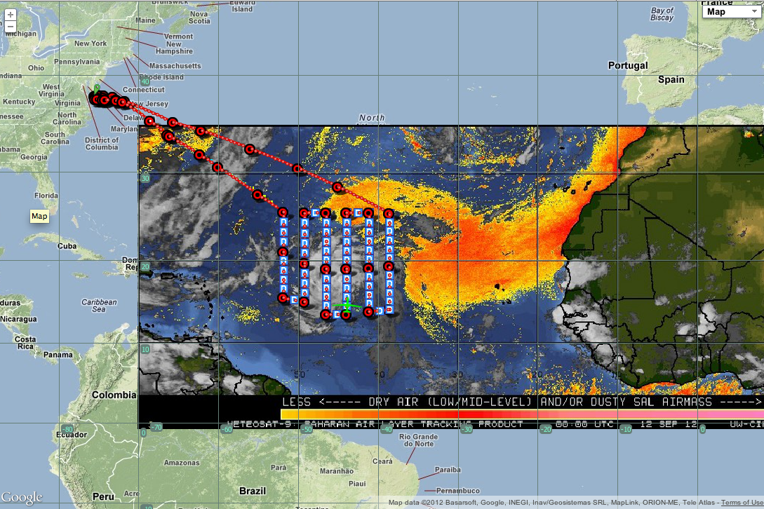
|
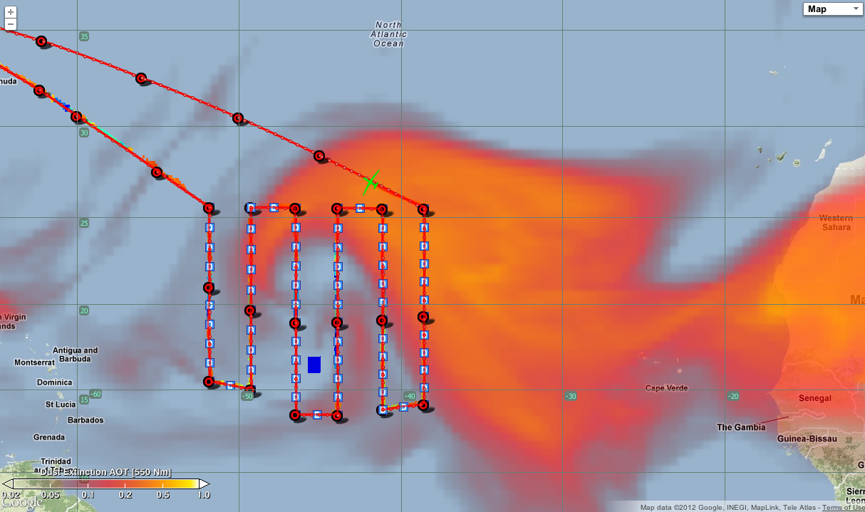
S-HIS BT (1579-1613) over CIMSS SAL Tracking Product at 0145Z 12 Sep 2012 (full Atlantic Basin view) - Sampling region of dry SAL air, based on CIMSS SAL tracking product.
|
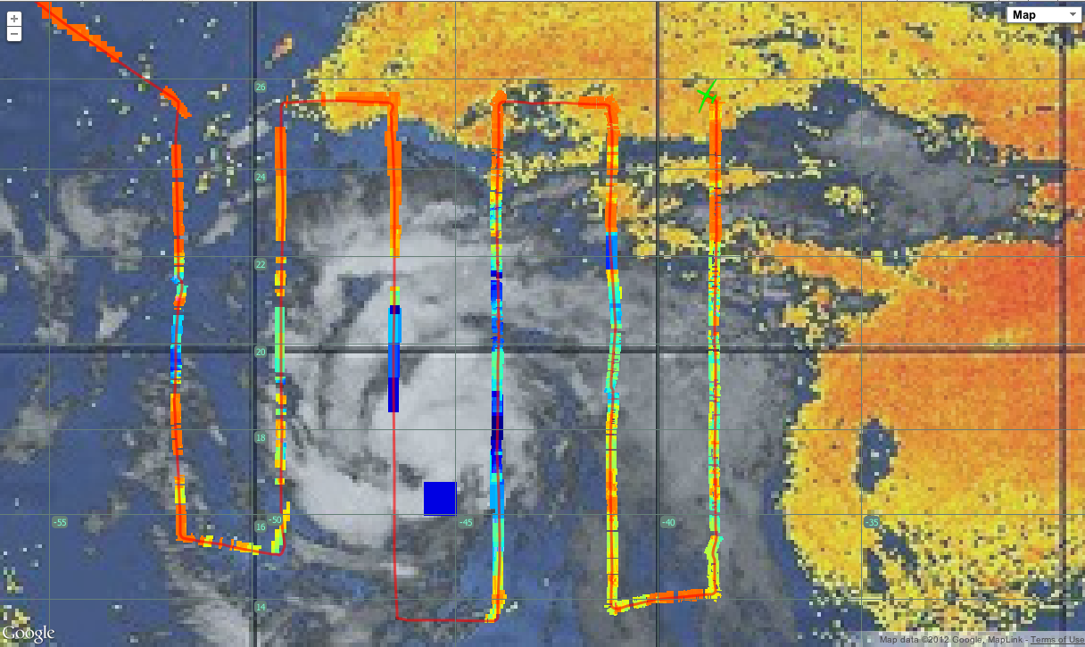
| SHIS_BT1579-1613_0206Z.png |

|
S-HIS BT (1579-1613) over GOES IR at 0206Z 12 Sep 2012 - Global Hawk has left SAL region. Now seeing BT signatures of the thin clouds associated with P24L's circulation.
|
| SHISandSAL_0300Z.png |

|
S-HIS BT (1579-1613) over CIMSS SAL Tracking Product at 0300Z 12 Sep 2012 - Global Hawk in region of medium thickness clouds. Note that there was a Ku outage for about 6 minutes when the GH was at about 22N 41W, resulting in the segment of cold BTs in a dry SAL region.
|
| CPL_0305Z.png |

|
CPL QuickLook for 0211-0226Z 12 Sep 2012- CPL QuickLook profile history for period from 0211z to 0226z. Gives a nice view of the low/mid-level clouds, which are quite optically thick.
|
| SHISandSAL_0324Z_nowNadine.png |

|
S-HIS BT (1579-1613) over CIMSS SAL Tracking Product at 0324Z 12 Sep 2012 - GH continues to move through low/mid-level clouds associated with the outflow. P24L has been named TS Nadine as of the 3z 12 Sep 2012 NHC Outlook.
|
| TrackOverTPW_0344Z.png |
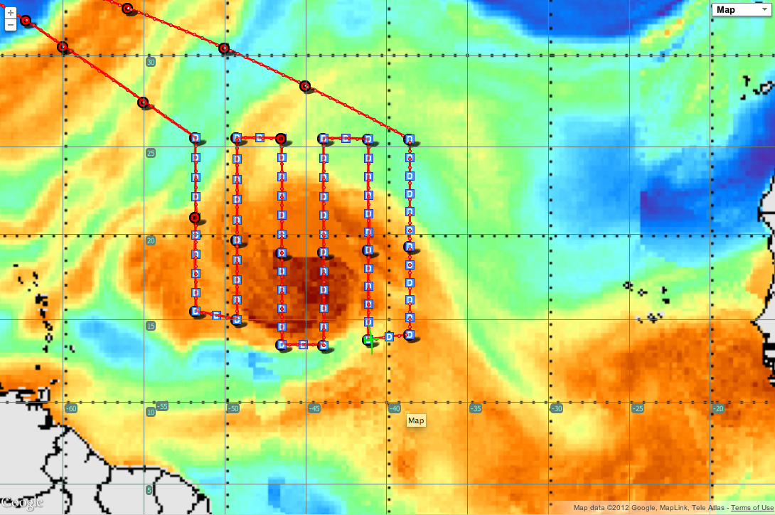
|
Flight track over TPW at 0344Z 12 Sep 2012 - Moving from lower TPW to a region of higher TPW as GH turns into last westward leg of the flight.
|
| TrackOverTPW_0344Z_fullAtlBasin.png |

|
Flight track over TPW at 0344Z 12 Sep 2012 (full Atlantic basin view) - Moving from lower TPW to a region of higher TPW as GH turns into last westward leg of the flight.
|
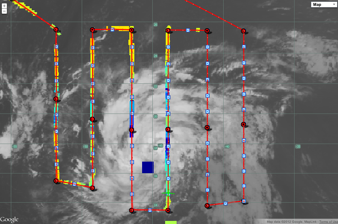
| completePatternOverSAL1_0615.png (zoomed out) |

| S-HIS BT (895-905) over SAL at 0615Z 12 Sep 2012 - After completing the lawnmower pattern over TS Nadine, the GH flies into a strong SAL region. (zoomed out) |
| completePatternOverSAL2_0615.png (zoomed out) |
| S-HIS BT (895-905) over SAL at 0615Z 12 Sep 2012 - After completing the lawnmower pattern over TS Nadine, the GH flies into a strong SAL region. |
| completePatternOverIR1_0610.png (zoomed out) |

| S-HIS BT (895-905) over IR at 0610Z 12 Sep 2012 - After completing the lawnmower pattern over TS Nadine, the GH flies into clear skies (our favorite!). (zoomed out) |
| completePatternOverIR2_0610.png |

|
S-HIS BT (895-905) over IR at 0610Z 12 Sep 2012 - After completing the lawnmower pattern over TS Nadine, the GH flies into clear skies (our favorite!). |
| flightPath_returnThruSAL.png |
|
Flight path showing the return right through the strong SAL region to the northeast of Nadine.
|
| flightPath_returnThruSAL_Close.png |
|
Flight path showing the return right through the strong SAL region to the northeast of Nadine. (close up)
|
| returnThruDustExt.png |
|
S-HIS BT (1579-1613) 0756z 12 Sep 2012 over GEOS5 Dust Extinction AOT (550 nm)
|
| SHISandDustExt_0756.png |
|
S-HIS BT (1579-1613) 0756z 12 Sep 2012 over GEOS5 Dust Extinction AOT (550 nm) close up.
|
| CPL_0636-0645.png |
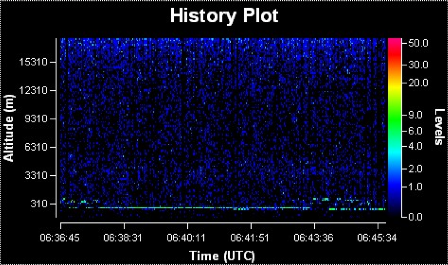
|
CPL from 0636-0645z 12 Sep 2012 (through SAL) - Slightly lighter signals at ~3310 m indicates a possible SAL dust layer.
|
