| Name |
|
Description |
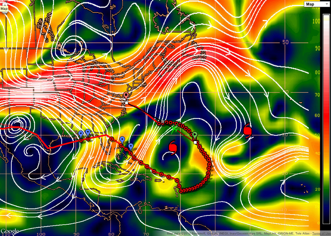
| 20120907_cimss_wind_shear1.png |
|
Ferry flight track shown over CIMSS wind shear product. Locations of TS Leslie (further west) and TS Michael (further east) are indicated.
|
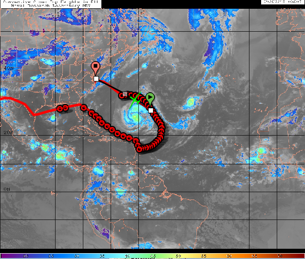
| 20120907_leslie_michael_cloud_top_heights2.png |
|
Flight track shown over cloud top heights.
|
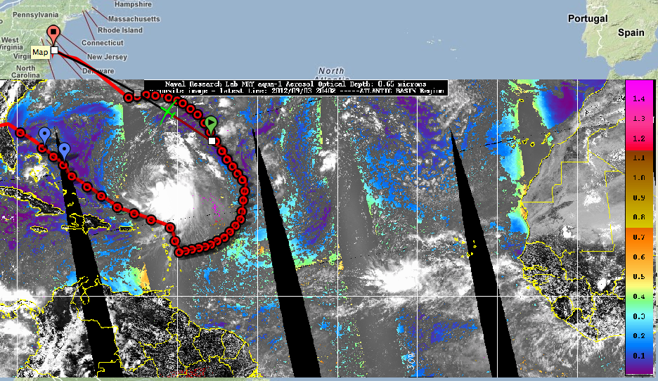
| 20120907_aerosol_od.png |
|
Flight track shown over Atlantic basin composite of aerosol optical depth.
|
| 20120907_leslie_michael_cloud_top_heights.png |

|
Flight track around Leslie over cloud top heights. Michael is to the east.
|
| 20120907_leslie_michael_water_ir1.png |

|
Flight track around Leslie over IR imagery. Michael is to the east.
|
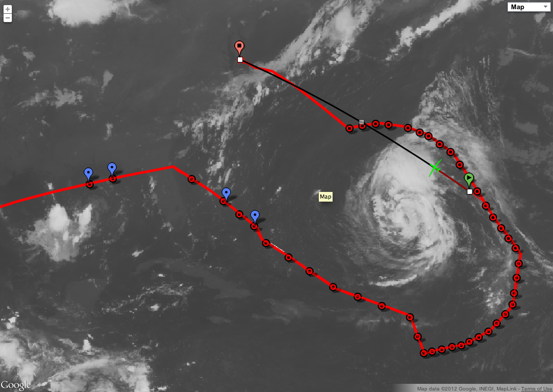
| 20120907_goes_ir_leslie1.png |
|
Flight track around Leslie over IR imagery. (zoomed out view)
|
| 20120907_leslie_michael_water_vapor1.png |

|
Flight track around Leslie over water vapor IR imagery. Upper levels winds are shown (cyan: 100-250 mb, yellow: 251-350 mb, green: 351-500 mb).
|
| 20120907_water_vapor_winds_leslie1.png |

|
Flight track around Leslie over water vapor IR imagery. Upper levels winds are shown (cyan: 100-250 mb, yellow: 251-350 mb, green: 351-500 mb). (zoomed out view)
|
| 20120907_map_track1.png |

|
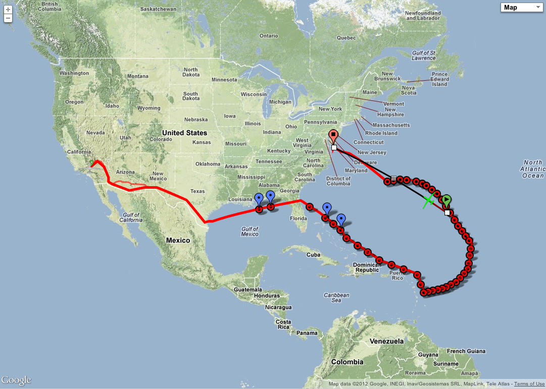
Ferry flight track, centered on CONUS.
|
| 20120907_map_track2.png |
|
Ferry flight track, centered on TS Leslie.
|
| 20120907_drop4_map1.png |
|
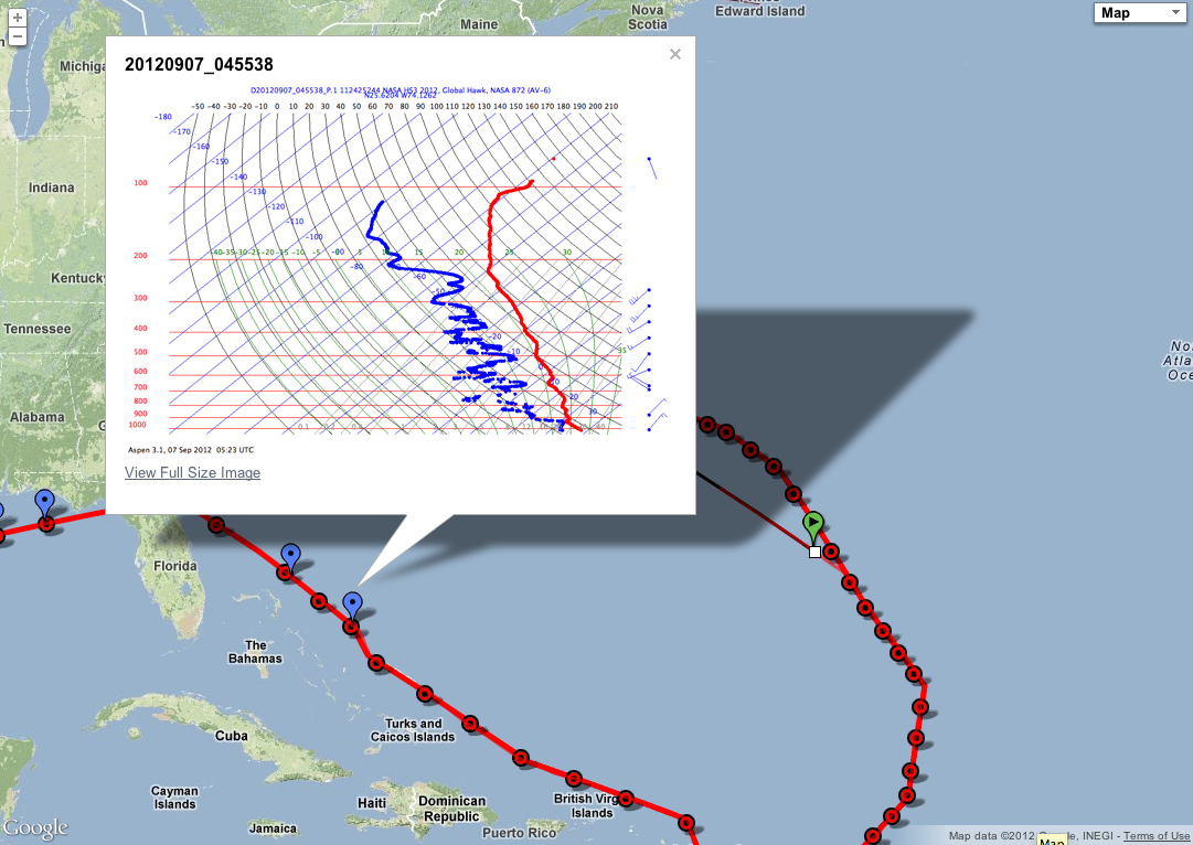
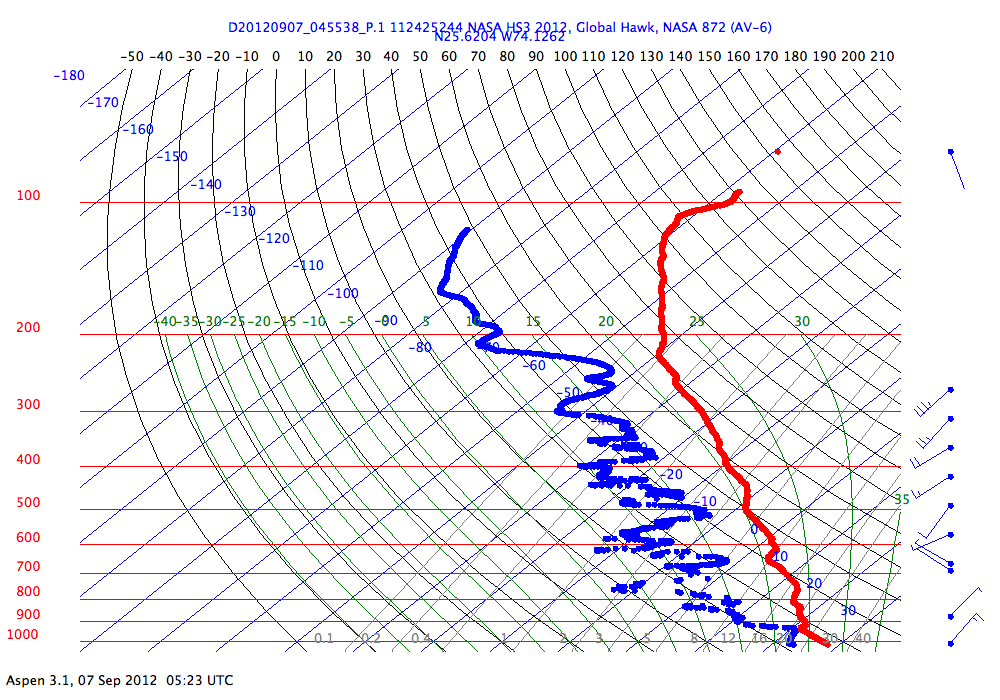
Flight track with dropsonde location and skew-T from 0455z 07 Sep 2012.
|
| D20120907_022056_Pskewt.png |

|
Skew-T from 0220z 07 Sep 2012.
|
| D20120907_024118_Pskewt.png |
|
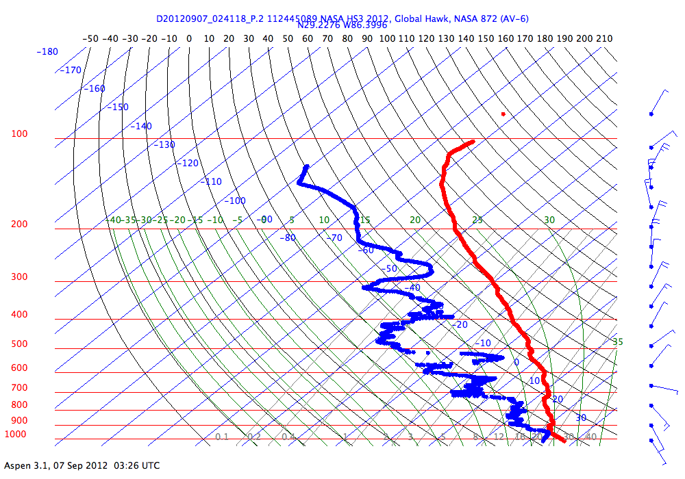
Skew-T from 0220z 07 Sep 2012.
|
| D20120907_042501_Pskewt.png |
|
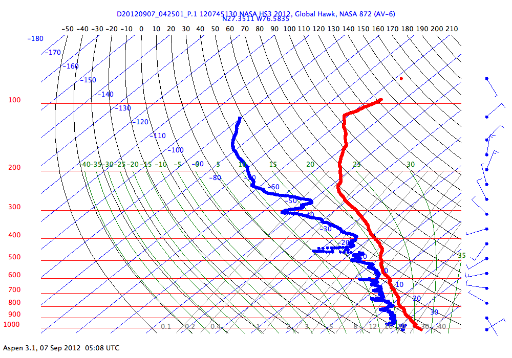
Skew-T from 0425z 07 Sep 2012.
|
| D20120907_045538_Pskewt.png |
|
Skew-T from 045538z 07 Sep 2012.
|